
There’s nothing more fascinating (well to me!!) than visual research tools.
I love time lines and I love old newspapers online and now I love SIX maps. You’ll find them at http://maps.six.nsw.gov.au/
The New South Wales Government has made available aerial maps of Sydney and part of their basemaps include photographs taken from 1943.
It is fascinating to chose the maps and then move the slider toolbar up and down to see how things have changed in 70 years.
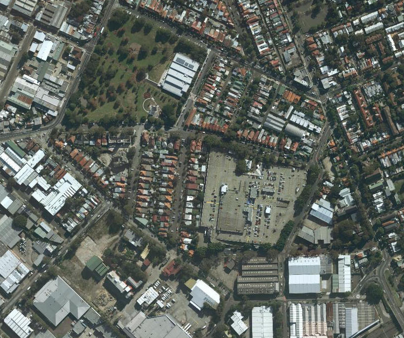
For example, look at this view above Enmore Park and Marrickville Metro Shopping centre. It is a fairly recent photograph showing the newish Aquatic Centre and the Metro is busy with a lot of cars parking on their upper level.
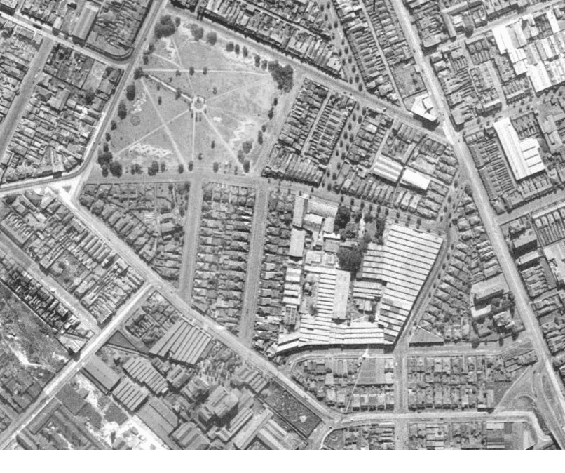
Our second map, from 1943 shows similar paths in the layout of the park, however there is nothing in the top right corner. The trees are immature and what are those markings on the ground? Was Enmore Park used for air raid shelters? I have seen similar markings in the Yeo Park image when I was looking for where air raid shelters had been placed.
Vicars mills were a huge operation. We can see that their buildings took over the entire Marrickville Metro site.
We can see the building next to Bethesda Nursing home didn’t exist either in 1943.
I can imagine this tool would be perfect for helping to discover answers to a number of mysteries. It’s a shame the zoom isn’t extensive .. and oh imagine how wonderful if we had Street View for 1943.
I hope you enjoy this time machine as much as I have been. What mysteries will you uncover?

Really very good article and very unique list of various kind of sites. I have used some sites from this list and i found its really impressive.Thanx for sharing
LikeLike