
Laurel Horton, guest contributor
A version of this article first appeared in the Inner West Courier 02/04/2019
Poor roads, tolls, and the destruction of properties are constantly in today’s news. Was it any different in the past?
Cooks River Road had started as a track but by the 1830s it was becoming a favourite drive with Sydneysiders. But for the unfortunate settlers on Cooks River and around, this bush road became impassable in rainy weather.

Picture credit: St Peters Cooks River History group collection.
The construction of a dam across Cooks River between 1839 and 1840 was a significant development in the creation of the road. It was becoming more important as a thoroughfare but nothing was being done to improve the road itself.
In 1843 the Cooks River Road Trust was formed. The trust was able to charge tolls which were used for the upkeep of the road. The first toll gate was in Newtown between Carillon Avenue and Forbes Street. In 1849 an additional toll gate was established at Cooks River and then in 1860 another at Newtown railway bridge. With three tolls to pay, people were not happy especially when one toll gate operator demanded a toll from a funeral.
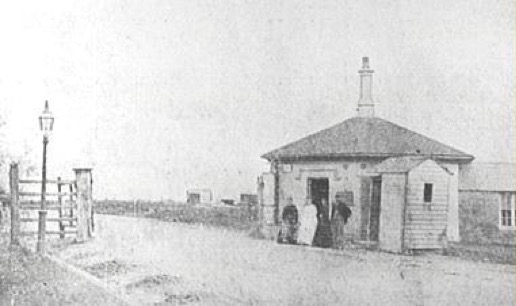
The operator caused uproar by demanding a toll from a funeral.
Photo credit: 1912 Newtown Jubilee Souvenir Booklet (p.161).
The toll gates at Newtown Bridge and St Peters were finally removed in 1877 and the road trust was abolished. Then in 1891 the dam across Cooks River was replaced by a wooden bridge, having a positive effect on the river.
By 1926 Cooks River Road was a major thoroughfare and carried a double line of tramway, but was only 43 feet wide in some places. The Main Roads Board proposed its widening from St Peters to Tempe. The widening involved the demolition of about two miles of shops and dwellings and the removal of remains in a portion of St Peters graveyard.
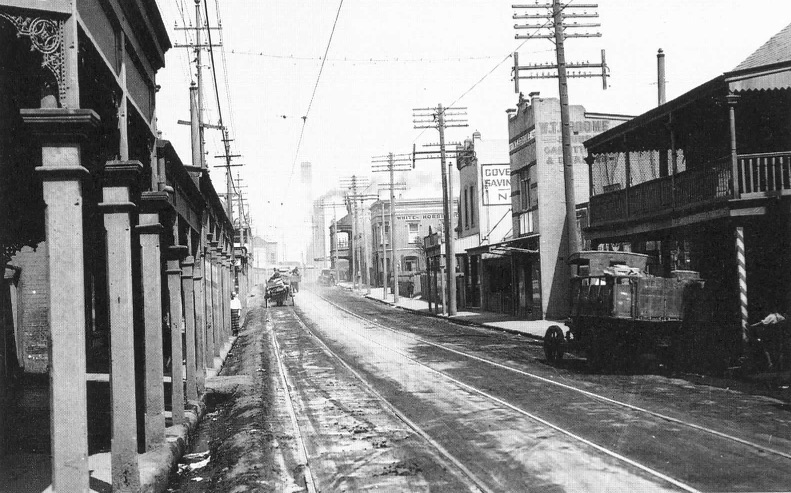
White Horse Hotel in background on right.
Photo credit: Department of Main Roads
The revamped suburb of St Peters was to be an entirely different place. No longer would any new wooden buildings be allowed along the road; Council required that they be made of brick. The road was completed in 1928 and renamed Princes Highway after Prince Edward (later King Edward VIII) who had visited Australia in 1920. This is the road you see today.
